
New Perspective Geosolutions
Providing flexible, tailored geophysical solutions to the resources sector
Services
This is a broad outline of seismic geophysical services offered. However, feel free to get in touch to discuss anything of a geophysical nature outside this scope.

Acquisition
-
Seismic acquisition planning and survey design
-
Seismic acquisition service tendering, bid analysis and recommendation
-
Design of vibrator source parameter test plan and analysis of results
-
Checkshot/VSP program design
Processing
-
Seismic data processing service tendering, bid analysis an recommendation
-
Oversight/QC of execution of processing services, client liaison
-
Basic processing capabilities (filtering, scaling, mute design/testing)

Interpretation
-
Building interpretation projects in industry-standard software packages
-
Sourcing publicly available seismic, well and supporting data (infrastructure, DEMs, imagery, regional maps, existing interpretation etc.)
-
2D/3D seismic fault/horizon interpretation
-
Velocity model building and depth conversion
-
Incorporation of complimentary data, e.g. gravity/magnetics, outcrop
-
Production of key interval maps
-
Prospect generation
-
Formation top prognosis to assist well planning
-
Structural model building suitable for input into static modelling
-
Report writing to meet regulatory requirements

Positioning and GIS
-
Validation of seismic data positioning and datuming
-
Investigation and remediation of inaccurate/incorrect/missing positioning coordinates in vintage seismic data
-
Georeferencing of historic maps/scans
-
Digitising map features (prospects, pipelines, faults, contours etc.)
-
Final map generation

About
Nathan has over 20 years’ experience in the oil and gas sector, with the last 10 years spent in seismic interpretation with an onshore gas exploration company, and 10 years prior to that in seismic acquisition and processing with a large multinational service company.
He has experience in all aspects of utilising seismic, along with gravity and magnetics, for oil and gas exploration; geologic model building, play mapping and resource evaluation and in providing geophysical advice to support reservoir engineering and drilling activities.
Nathan is well versed in industry-standard seismic interpretation packages, GIS software and report writing. Hence, the scope of services available can be tailored to your needs, from integrating into existing teams for short-term projects, to providing full geophysical support to smaller operators with limited staffing resources.
Qualifications: BSc (Hons) Geophysics
Memberships: SEG, ASEG, PESA
LinkedIn profile: n8-palmer
Project Highlights
Below is a selection of successfully completed past projects, highlighting the key steps involved, as an indication of what can be performed by NPgeo.

2D Seismic Interpretation
2022
#interpretation
Interpretation of 2D onshore seismic data over newly acquired permits. Dataset consisted of 304 2D seismic lines and 38 wells.
Work performed involved:
-
Seismic and well data loading and verification
-
Seismic datuming and mis-tie correction
-
Synthetic trace generation and identification of key reflectors
-
Fault/horizon interpretation
-
Velocity modelling and depth conversion
-
Final mapping and report writing

2.5D Seismic Survey Design
2023
#acquisition, #processing
Seismic acquisition survey design and processing QC of a 2.5D testline. The line was acquired and used to inform optimal parameters for a subsequent full 2D seismic acquisition program.
Work performed involved:
Review of historic seismic data, identification of noise issues and strengths/weaknesses of acquisition parametersemployed
Survey design of 2.5D seismic testline in an iterative process
Discussions held with various experts and relevant guidance incorporated into the survey design
Tendering and bid analysis for processing services
QC/oversight of execution of processing services
Analysis of final testline data and recommendations

2D Seismic Processing QC
2024
#processing
Procurement of seismic data processing services.
Work performed involved:
-
Prepare information pack for bidding of processing services (project background, regional geology, previous work conducted etc.)
-
Discussions/interviews with respondents
-
Tendering and bid analysis for processing services
-
Document and provide recommendation
Clients and Collaborators
Work has been performed either on behalf of, or in collaboration with, the following companies:


Software
NPgeo's preferred interpretation package is SLB's Petrel/Delfi package.
However, software licensing options are able to be tailored to meet any project budget. The following packages are used and/or can be acquired on a project basis:
Interpretation


Mapping


Downloads
Here you'll find links to some walkthroughs published on LinkedIn, covering aspects of geology and geophysical data acquisition, processing and interpretation.
Check back often as the content list is progressively growing.

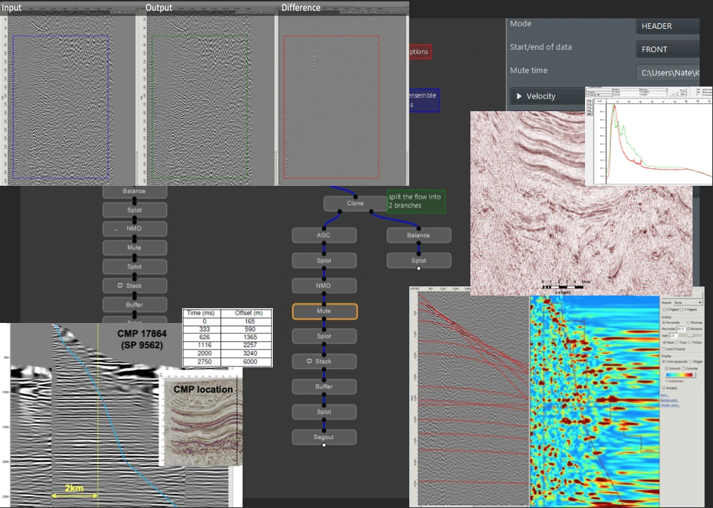
Headers Matter!
06/12/2022
2D seismic data can contain spatial positioning information in a number of trace header locations, and include a number of different versions. This is a guide to avoiding some common pitfalls when visualising 2D SEG-Y seismic lines.

Land Multiples
16/04/2024
Strong surface multiples are generally considered to be more of an issue in marine seismic data than land data. However, onshore examples also exist. Below is one such case with strongly reflective coals causing what looks to be an obvious surface multiple. A couple of quick diagnostic tests to further investigate this suspicion are also outlined.

Well Log Substitution
17/05/2024
Amongst the requirements to generate a synthetic seismogram at a well are sonic (DT) and density (RHOB) logs. A particular case is discussed here where operational issues resulted in a gap in coverage in these logs. Rather than relying on equations such as Gardner/Faust, alternate logs were used to infill the missing coverage.
Colour Maps
2D Migration Basic Theory
17/04/2025
As a follow-up to the previous video above, here is a basic, practical explanation of how migration works within a seismic data processing context; particularly diffraction summation migration methods.
2D Migration Data Example
26/03/2025
Migration is a key step in a typical seismic data processing workflow. If you've ever been curious about what the migration process actually achieves, here's a short explanation showing a before/after comparison of 2D Kirchhoff migration on. a 2D onshore seismic line, along with some key observations highlighted.
Work with me
I'm happy to discuss how to best meet your geophysical objectives!
Send a message below to organise an introductory in-person or video meeting.